RADMApp
Aquatera’s in-house Resource Analysis and Digital Mapping Application (RADMApp) tool provides a GIS based framework for data analysis which is used as a powerful site selection tool for projects all over the world in many different types of projects and industries.
We understand that finding the right location is one of the most consequential decision you will make as you establish your project.
RADMApp, our GIS-powered raster-based framework, ensures that your site-selection is evidence based - taking the guesswork out of siting complex projects.
RADMApp brings data-driven clarity to site selection, at any scale, anywhere in the world.
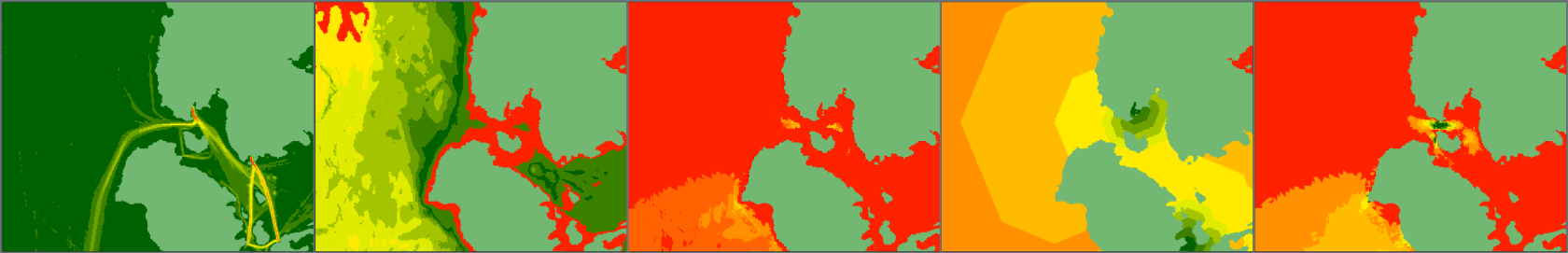
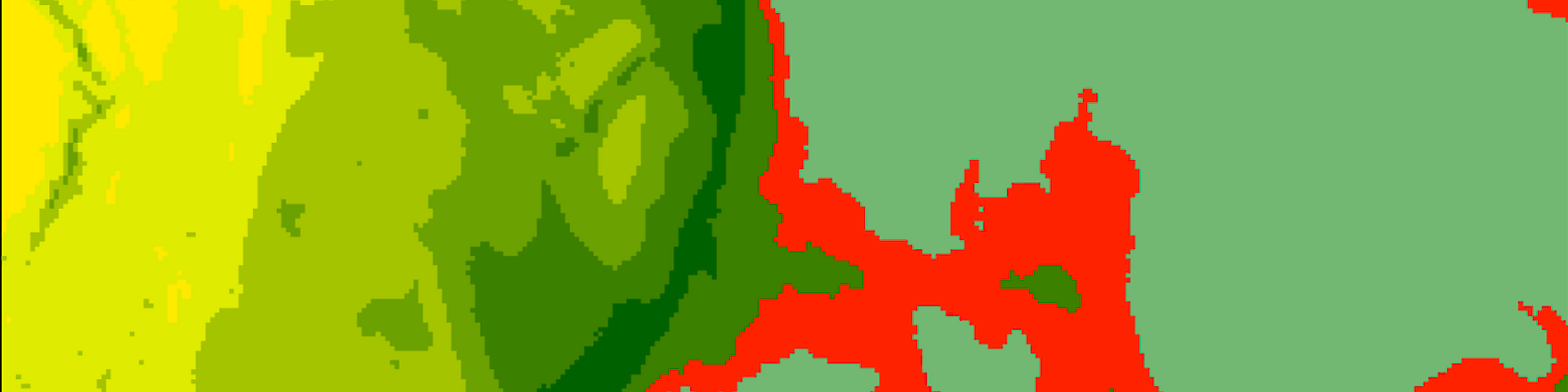
Aquatera’s RADMApp tool is a raster-based GIS framework for data analysis which can be applied to many different scenarios. The tool helps to establish a robust framework by seeking to identify the key decision factors and types of data that need to be considered during site selection; from planning zones and conservation designations, to available wind, tide and sun resource, or social, cutural and economic activity data. It provides a universal and comparable system for classifying the levels of suitability for each criteria, so each one can be scored and weighed and suitable site options identified.
RADMApp is capable of handling 500 million pixels of data in each input and output layer as well as in the associated interactions, aids the decision-making process for Spatial Planning through resource assessment and identification of potential development zones. This model provides a holistic assessment and mapping of the physical environment through a universally comparable system for assessing suitability based on a range of criteria. The tool can easily interface with, handle data from, and generate data to be used by other geographical data tools and presentational frameworks. RADMApp assesses flexible, sensitive and insightful frameworks associated with the interactions that come from activities, decisions, technology and facilities as well as established ecosystem, social and economic relationships.
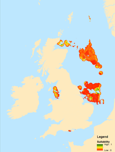
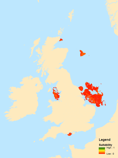
Aquatera’s RADMApp model has been successfully implemented into a wide range of studies in relation to resource and market assessments at local, national and global scales, resource assessments for renewables such as solar,tidal, thermal and wave energy, as well as other renewable energy related projects.
Comparing development approaches
Comparing technology options or contrasting sites with different grid connection distances or seabed conditions
Phased development planning
Identifying which areas offer the best near-term opportunities while preserving optionality for future expansion
Testing constraints
Applying or relaxing exclusion zones, buffer distances, or regulatory thresholds to understand how sensitive the results are to planning assumptions
Adjusting priorities
Reweighting criteria to reflect different commercial, environmental, or community objectives, and instantly seeing how the suitability picture changes
Stakeholder scenario modelling
Presenting multiple credible development scenarios to investors, regulators, or communities, underpinned by consistent, auditable methodology
Successfully applied globally and across sectors
- Renewable energy resource assessments (solar, tidal, wave, and thermal)
- Onshore wind suitability for project developers
- Strategic wave and tidal energy mapping
- Route and site selection for onshore and offshore electrical transmission
- Aquaculture site selection
Technical feasibility
- Engineering feasibility
- Natural hazards
- Climate resilience
Costs and revenue
- Development cost
- Return on investment
- Market access
- Funding availability
Project impacts
- Protected and sensitive habitats and species
- Cultural and heritage sites
- Community acceptance
- Socio-economic impacts
- Compatability with other land/sea uses